

Long

Brief Description
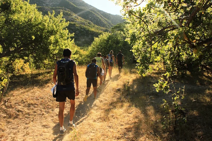
This is an advanced hike of more than 21 kilometers (13 miles) that follows an historical trail that was carefully reconstructed by our crew in 2015 and 2016. Relied upon by the mining community of Cacachilas in the mid to late 1800s, this trail was used to transport goods by mule to La Paz when traveling by sea was not possible due to inclement weather.
The three-minute video below was filmed in 2017 using an aerial drone and shows much of the trail scenery. Be sure to also visit the Don Diablo Trail Run website that describes our highly challenging, 35-kilometer (21.75-mile) and 54-kilometer (33.55-mile) mountain running races that begin with this route, starting from the La Paz side, and then continue on our Bandolero, Cueva del Indio and Sky trails, to reach El Sargento. On this other site, you will find more photographs, as well as information about Don Diablo himself whose footsteps you will be following as you hike this trail.
Detailed Description
The Long Trail includes three major climbs: Portezuelo de Caballos, Portezuelo de La Calerita, and Portezuelo de La Bebelama.
It is at El Toro, an intersection of various trails, that we begin our journey. With a relatively easy start, we soon come upon a trail on our right that leads to a location that was once inhabited by nomadic hunter-gatherers. For now we continue straight, and after encountering a brief descent, we reach the first major challenge — Portezuelo de Caballos.
Near the summit of Portezuelo de Caballos, we reach an intersection with another trail that leads to the Agua Blanca spring. For overnight trips, this detour can be added to the journey to stock up on water and enjoy a rest under the shade of the surrounding trees. If you are booked to hike the entire Long Trail in one day, we usually plan to push on ahead rather than take time out to visit the spring.
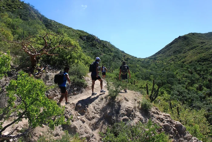
At the summit you are rewarded with views of Cerralvo Island and the Sea of Cortez. You also have a bird's-eye view of much of the vast Rancho Cacachilas landscape. See video above for examples of sweeping views.
After descending about 2 kilometers (1.2 miles) you come to Paraje del Culantrillo, a traditional camping location for cattle ranchers. Surrounded by granite rocks and wild plum trees, this makes for an ideal place to spend the night.
Farther ahead, we come upon another possible camp site — Paraje del Mascarillo. Here you can explore Las Pozas de San Juan, a large set of natural pools that are hidden in the deepest part of the canyon. Naturally carved from solid rock, they host some of the largest crawfish that our scientific teams have ever seen. From Mascarillo begins the second ascent, the climb to Portezuelo de La Calerita.
Once you reach the apex of Portezuelo de La Calerita, you are approximately halfway in your journey. Notice the change in the ground; this terrain is composed primarily of rock. Just a short way ahead, you arrive at Paraje de Vidal, another cattle ranchers' campsite, this one quite small and with a rustic roof.
Finally, you reach the last major climb to Portezuelo de La Bebelama. This ascent is shorter in length than the previous ones and at the top you see the first views of the Bay of La Paz.
El Barrito is another pretty campsite along the route, surrounded by granite boulders with a large Palo de San Juan tree at its center. Green year round, this local tree provides welcome shade from the sun. Beware, however, of the local tale associated with this spot, and be sure to ask your guide to explain the details.
El Paraje del Ciruelo comes next, and offers a natural spring that, at certain times of the year, can be a good source for replenishing bottles and other receptacles.
Portezuelo de Las Pitahayas is the final short ascent, only about 200 meters (219 yards) long. Soon you will arrive at La Palmilla, our endpoint. Congratulations, you have completed the Long Trail!


— Click images to enlarge. Use arrows left and right to scroll. ESC to return to page. —